|
|

Ladakh
LADAKH is a mysterious land shrouded in
myth and legend.Much of its ancient history is known only through the mythology
of its people as its written history is of very recent origin.Known for
centuries as the 'land of passes' (La-pass;Dakh-land),Ladakh was described by
Fa-hian,who travelled across its inhospitable terrain in 399 A.D.,as 'The land
where snow never melts and only corn ripens'.
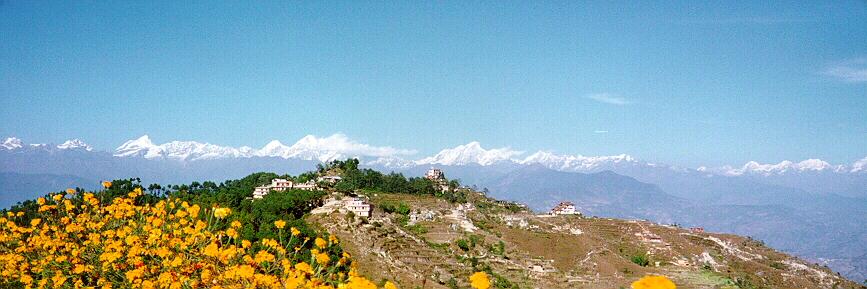
Its landscapes are forbidding by any
measure.Snow-swathed mountains rise to several thousand feet above one of the
most elevated plateux on earth.A treeless wind-swept country, much of Ladakh can
be termed as mountains,Arctic desert,where everything is parched bt the rarefied
dryness of the atmosphere.Scattered here and there, a few narrow fertile valleys
provide a stark contrast to an otherwise barren,beautiful country of intense
sunlight and clear sparkling air.The limpidity of the atmosphere, in fact gives
the night sky a unique clarity, so full and bright with stars that one feels
transported to some etheral setting far removed from earth. For endless years,
mad had even discovered this remote land,several hardy animals and birds lived
together here in an exquisite equilibrium.Circumstances have now changed as they
have almost everywhere else on the subcontinent.Today,Ladakh's flora and fauna
are threatened and protection is vital if the ancient ecosystems are to survive
the trauma of modern man.Through the fabric of this account runs a strong
statement,that the armed forces possible contribution to conservation remains
untapped.Harnessing this vital potential force may be the single most important
conservation advance India could make in the battle to save what remains of its
natural wealth.
Top
DRASS
Drass (3230 m), 60 km west of Kargil on
the road to Srinagar, is a small township lying in the centre of the valley of
the same name. It has become famous as the second coldest inhabited place in the
world by virtue of the intense cold that descends upon the valley along with
repeated snowfalls during winters. Winter temperature is sometimes known to
plummet to less than minus 40 degrees.
The Drass valley starts from the base
of the Zojila pass, the Himalayan gateway to Ladakh. For centuries its
inhabitants are known to have negotiated this formidable pass even during the
most risky period in the late autumn or early spring, when the whole sector
remains snow-bound and is subject to frequent snow storms, to transport trader's
merchandise across and to help stranded travellers to traverse it. By virtue of
their mastery over the pass they had established a monopoly over the carrying
trade during the heydays of the Pan-Asian trade. A hardly people enduring with
fortitude and harshness of the valley's winter, the inhabitants of drass can
well be described as the guardian's of Ladakh's gateway.
Drass is a convenient base for a 3-day
long trek to Suru valley across the sub-range separating the two valleys. This
trek passes through some of the most beautiful upland villages and flower
sprinkled meadows on both sides of the 4500 mts high Umbala pass, which falls
enroute. The trek to the holy cave of Amarnath in neighbouring Kashmir, which
stars from Minamarg below Zojila, takes 3 days and involves crossing of 5200 mts
high pass. Drass also offers numerous shorter treks and hikes to the upland
villages.
Top
ZANSKAR
About 20 kms. South of Rangdum stands
the Pazila watershed across which lies Zanskar, the most isolated of all the
trans Himalayan Valleys. The Panzila Top (4401 m) is the picturesque tableland
adorned with two small alpine lakes and surrounded by snow covered peaks. As the
Zanskar road winds down the steep slopes of the watershed to the head of the
Stod Valley, one of Zanskar's main tributary valleys, the majestic "Drang-Drung"
glacier looms into full view. A long and winding river of ice and snow, the
Drang-Drung" is perhaps the largest glacier in Ladakh, outside the Siachen
formation. It is from the cliff-like snout of this extensive glacier that the
Stod or Doda River, the main tributary of river Zanskar, rises.
Zanskar comprises a tri-armed valley
system lying between the Great Himalayan Range and the Zanskar mountain; The
three arms radiate star-like towards the west, north and south from a wide
central expanse where the region's two principal drainage's meet to form
the main Zanskar River. It is mainly along the course of this valley system that
the region's 10,000 strong, mainly Buddhists population lives. Spread over an
estimated geographical area of 5000 sq. kms. High rise, mountains and deep
gorges surround Zanskar. The area remains inaccessible for nearly 8 months a
year due to heavy snowfall resulting in closure of all the access passes,
including the Penzi-la. To-day, Zanskar has the distinction of being the least
interfered with microcosms of Ladakh, and one of the last few surviving cultural
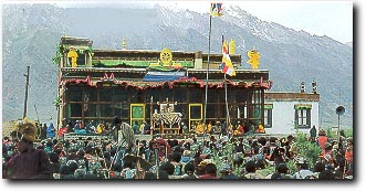
satellites of Tibet. Within the mountain ramparts of this lost Shangrila stand a
number of ancient yet active monastic establishments. Some of these religious
foundations have evolved around remote meditation caves believed to have been
used by a succession of famous Buddhist saints for prolonged meditation in
pursuit of knowledge and enlightenment.
Top
SURU VALLEY
One of the most beautiful regions of
Ladakh , the Suru Valley forms the mainstay of Kargil district. Lying nestled
along the north-eastern foothills of the great Himalayan Wall, it extends from
Kargil town, first southward for a length of about 75 Kms Upto the expanse
around Panikhar, thence eastward for another stretch of nearly 65 kms upto the
foot of the Penzila watershed where the Suru valley rises. Its composite
population of about 30,000 -- mainly of Tibeti-Darad descent -- are Muslims who
had converted their Buddhist faith around the middle of the 16th century. The
upper valley reaches of the valley, particularly around the Sankoo bowl, the
Panikhar expense and the higher stretch beyond, present a spectacle of
breathtaking features-majestic mountain ramparts crowned by snow capped peaks,
undulating alpine slopes draining into wild mountain streams of foaming cascades
of pristine water, awesome glaciers descending along the Himalayan slopes to the
river bed in riverine formation, Quaint villages of adobe houses straggling dry
hillocks surrounded by large tracts of lush crops downward the patches of alpine
pastures uphill. The beauty of this region is further enhanced by the sheer
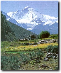
contrast provided by the towering peaks of Kun (7035 m)and Nun (7135 m) which
loom over the skyline in their crystalline majesty.
Top
RANGDUM
At a height of 3657 m rangdum is the
farthest and the most isolated part of the Suru Valley. It is an elliptical
expanded plateau surrounded by colourful hills on the one side and glacier
encrusted rocky mountains on the other. Situated 130 kms South- east
of Kargil, it falls midway between Kargil and Padum. Due to its remoteness from
inhabited parts either of Suru or Zanskar, the areas wild beauty is almost
haunting, while its isolation is near perfect even as the unpaved Zanskar road
traverses its length. The chief attraction of this area is an imposing 18th
century Buddhist monastery with about 40 monks in residence. Perched
picturesquely atop a centrally rising hillock which is entrenched around by the
bifurcated course of a wild mountain stream, the Rangdum monastery has the aura
of an ancient fortification guarding a mystical mountain valley. The villagers
are descendents of the monastery's agricultural, serf-tenants, who do not own
any land in the region. The monastery enjoys perpetual and unalienable o
wnership of the entire valley including the fields tilled by the villagers, the
pastures, hills and even the streams. Rangdum also serves as an important
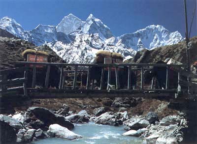
trekking base. The most popular trek from here leads to Henaskut near Lamayuru,
across the spectacular gorge of the kanji valley. This 5-day trek also forms the
last leg of the two week long trans-Himalayan traverse between Kashmir and
Ladakh.
Top
|
|